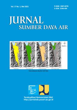
HIDROSTRATIGRAFI DAN GEOMETRI AKUIFER CEKUNGAN AIR TANAH PALU, PROVINSI SULAWESI TENGAH PASCA GEMPA BUMI
DOI:
https://doi.org/10.32679/jsda.v17i1.695Abstrak
Palu Groundwater Basin can be assumed to have a post-earthquake deformation in 2018. To identify current state of Palu Groundwater Basin, modeling approach was conducted using GMS 10.4 (Groundwater Modeling System) with IDW (Inverse Distance Weighting), with the data used for the model was obtained from 41 boreholes. The results show that Palu Groundwater Basin aquifer geometry can be divided into 4 types. The unconfined aquifer consisting of Alluvium and Coastal Deposits (Qa) have an area 412,69 km², with 17,77 - 72.48 m thickness top layer have elevation 341 MSL (mean sea level) and bottom layer have elevation -2,29 MSL. Top aquitard consisting of Celebes Mollase of Sarasin and Sarasin (QTms) have an area 391,1 km² with 0.1 - 20,61 mm thickness top layer have elevation 268,52 MSL and the bottom of layer have elevation -20,06 MSL. Confined aquifer consisting of Celebes Mollase of Sarasin and Sarasin (QTms) have an area 351,98 km² with 20,58 - 86,51 m thickness top layer have elevation 268,42 MSL and bottom layer have elevation -40,67 msl. Bottom aquitard consisting of Granite and Granodiorite (Tmpi), Tinombo Formation (Tts), Metamorphic Complex (Km), Latimojong Formation (Kls) have an area 78,24 km² with 20,58 - 86,51 m thickness 3,01 - 4,1 m top layer have elevation 181,91 MSL and bottom layer have elevation -29,09 MSL
Keywords: Groundwater, basin, modeling, geometry, aquifer
Unduhan
Diterbitkan
Cara Mengutip
Terbitan
Bagian
Lisensi
The Authors submitting a manuscript do so on the understanding that if accepted for publication, copyright of the article shall be assigned to Jurnal Sumber Daya Air and Pusat Penelitian dan Pengembangan Sumber Daya Air as publisher of the journal.Copyright encompasses exclusive rights to reproduce and deliver the article in all form and media, including reprints, photographs, microfilms and any other similar reproductions, as well as translations. The reproduction of any part of this journal, its storage in databases and its transmission by any form or media, such as electronic, electrostatic and mechanical copies, photocopies, recordings, magnetic media, etc. , will be allowed only with a written permission from Jurnal Sumber Daya Air and Pusat Penelitian dan Pengembangan Sumber Daya Air.
Jurnal Sumber Daya Air and Pusat Penelitian dan Pengembangan Sumber Daya Air, the Editors and the Advisory International Editorial Board make every effort to ensure that no wrong or misleading data, opinions or statements be published in the journal.


